The British Isles: UK, Great Britain & Ireland Worksheet
Great Britain, the United Kingdom, Ireland, England, Scotland, Wales… These names are often mixed up by English learners. This printable worksheet helps students understand the geography of the British Isles while practising useful English vocabulary.
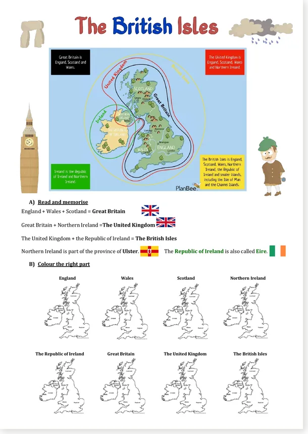
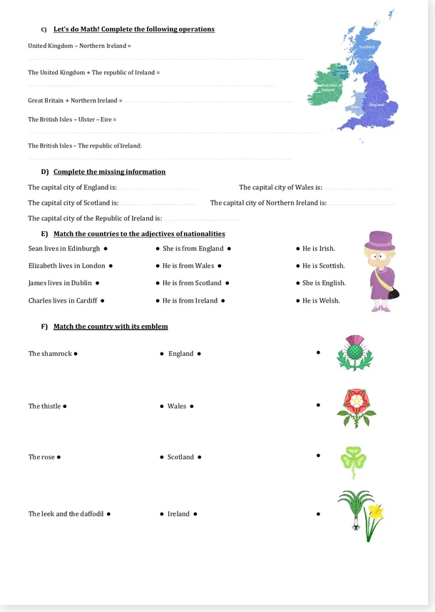
Students begin with a visual map, then identify and colour the different geographical areas. They continue with simple geography “operations”, complete the capital cities, connect places with nationalities and finally match each country with its traditional emblem.
✨ What students practise
This activity combines English and geography. Instead of learning a list of countries by heart, students work directly with maps, place names, capital cities, nationality adjectives and well-known national symbols.
Distinguish England, Wales, Scotland, Great Britain, Northern Ireland and the United Kingdom.
Colour the correct parts of the map for each geographical name.
Find the capitals of England, Wales, Scotland, Northern Ireland and the Republic of Ireland.
Match cities, countries, nationality adjectives and traditional emblems.
🧭 Great Britain, the United Kingdom… what is the difference?
The first part of the worksheet gives students a simple visual framework before they begin the exercises.
England + Wales + Scotland
Great Britain + Northern Ireland
Great Britain, Ireland and the surrounding islands
The independent country occupying most of the island of Ireland
✏️ Six activities in one worksheet
Read the basic geographical relationships between the countries and territories.
Locate England, Wales, Scotland, Northern Ireland, the Republic of Ireland, Great Britain and the United Kingdom.
Use additions and subtractions such as “Great Britain + Northern Ireland” to reconstruct geographical names.
Complete the capitals of England, Wales, Scotland, Northern Ireland and the Republic of Ireland.
Connect Edinburgh, London, Dublin and Cardiff with Scottish, English, Irish and Welsh.
Match the shamrock, thistle, rose, leek and daffodil with the appropriate country.
🎁 Download the free excerpt
Want to try the activity first? Download the free abridged PDF with Fred’s Worksheets watermark. It includes the introductory map and the first activities and is ready to print.
🎁 Free PDF excerpt
A free watermarked extract of the British Isles worksheet.
🔓 Want the complete worksheet?
Premium members can download the complete clean PDF and the editable Word version.
💎 Complete files for Premium members
The Premium version gives you the complete clean printable PDF plus the editable DOCX file. The Word version is particularly useful if you want to adapt the vocabulary, remove an activity, add instructions or personalise the worksheet for your class.
🎯 Recommended level
You can use the worksheet as a complete classroom activity, divide it into several shorter exercises, or use the map section as an introduction before a lesson about the United Kingdom and Ireland.
❓ Frequently asked questions
📚 What level is this British Isles worksheet for?
It is best suited to A1-A2 English learners. The language is relatively simple, while the maps and visual activities support students who are still developing their reading skills.
🗺️ What does the worksheet teach?
Students learn about England, Scotland, Wales, Northern Ireland, the Republic of Ireland, Great Britain and the United Kingdom. They also work with capital cities, nationalities and national emblems.
✏️ What activities are included?
The worksheet includes reading, map colouring, geographical word operations, capital-city completion, nationality matching and an activity about traditional national emblems.
🎁 Is there a free version?
Yes. A watermarked abridged PDF is available free of charge. The complete clean PDF and editable DOCX version are reserved for Premium members.
📝 Can I edit the worksheet?
Yes. Premium members can download the DOCX version and modify the activity in Microsoft Word or another compatible word processor.